
Gyeongju · Seoak-dong tombs & Seondosan
Hill of Kings, Buddha in the Rock
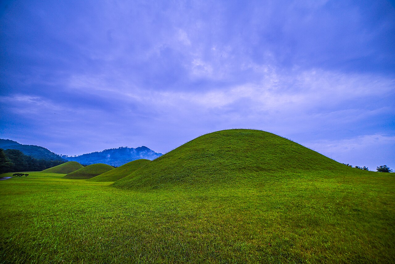
Start at the tomb of King Muyeol, with a row of giant mounds behind it, pass a stone pagoda and four more royal tombs, then climb Seondosan to a giant Buddha carved into the rock. On the way down, visit Seoak Seowon, an old academy honoring General Kim Yu-sin, and finish at the same bus stop. The 1.5 km climb is steep.
▶ Start listening in YaegiAt a glance
- Walking distance
- 5.4 km
- Time
- about 3 hours
- Stops
- 5 stops
- Starting point
- Tomb of King Taejong Muyeol
- Languages
- 한국어 · English · 中文
- Price
- Free for now
How it works
- Tap the button below and it opens in your browser. No app install or sign-up.
- Put your earphones in and walk. Narration starts by itself when you reach each stop. Without location on, you can tap to play the next stop.
- Subtitles show on screen. Each stop takes about 3 minutes to hear.
Route
- Tomb of King Taejong MuyeolThe Silla royal tomb that kept its name tag
- Seoak-dong Royal TombsFour giant tombs of unknown kings
- Stone Pagoda and Four Royal TombsA stone pagoda dressed as brick, and a deposed king
- Seondosan Rock-carved Buddha TriadA giant rock Buddha watching over the royal tombs
- Seoak Seowon AcademyA Joseon academy honoring General Kim Yu-sin
Know before you go
Best time
About 3 to 3.5 hours with rests. It starts at King Muyeol’s tomb and ends at Seoak Seowon, about a 5-minute walk from the Seoak·Muyeol Royal Tomb bus stop, so you finish close to where you began. Start at least 4 hours before sunset.
Fees and hours
- King Muyeol’s tomb: Check the fee at the gate. You see the tomb hill from inside King Muyeol’s grounds. The trail and the outside of Seoak Seowon are free.
Restrooms
Assume there are no restrooms on the mountain and go before you start, near the Muyeol tomb parking lot.
Parking
There is a parking lot in front of King Muyeol’s tomb (check fees first). The course ends near the start, so driving works too.
Common mistakes
- The 1.5 km from the pagoda to the Buddha triad is a steady steep climb (about 270 m of ascent). Go slowly and rest often.
- You come down the same trail you went up. It is steep, so wear shoes with good grip.
- You reach the tomb hill on the path inside King Muyeol’s tomb grounds. For the pagoda, go back out the gate and take the village lanes: there is no path straight from the tombs.
- The trail can close in the wildfire-prevention seasons (spring and autumn). Check the Korea National Park Service website first.
Please remember
- Please do not climb onto the tomb mounds.
- Please do not touch or climb on the Buddhas.
- Do not enter closed trails; you can be fined.
- If you get hurt, call 119. Keep your phone switched on.
What to bring
- Water (nothing to buy on the mountain)
- Hiking shoes or sneakers with good grip
- A charged phone and a power bank
- Earphones
FAQ
Can I skip the mountain?
Yes. King Muyeol’s tomb, the tomb hill and the pagoda are on fairly level ground. From the pagoda, head back down and over to Seoak Seowon: about 1 hour in all.
Does the narration start on its own?
GPS is unreliable in the woods, so it does not start on its own. Tap I'm here ▶ when you reach each stop.
Checked: Places: Korea Heritage Service coordinates with TMAP and OpenStreetMap (6 Nov 2026), rechecked against Naver Map (7 Nov 2026). Trails: paths shown on Naver Map (7 Nov 2026)
▶ Start listening in Yaegi